-
Notifications
You must be signed in to change notification settings - Fork 0
New issue
Have a question about this project? Sign up for a free GitHub account to open an issue and contact its maintainers and the community.
By clicking “Sign up for GitHub”, you agree to our terms of service and privacy statement. We’ll occasionally send you account related emails.
Already on GitHub? Sign in to your account
Tasking Manager 新規プロジェクト用 Markdown テンプレート #4
Comments
概略テンプレートEnglishHeavy Rain, Floods and Landslides happened in South West area of Japan. Disaster Volunteer teams are working in this affected area. 日本語日本の南西部に線状降水帯が長時間豪雨をもたらし複数箇所で洪水や土砂災害が発生しました。 日本赤十字社と連携し、彼らの活動エリアを中心にOpenStreetMapの建物データを充実させることを目的にこのタスクプロジェクトを立ち上げました。お時間ある方、ご協力よろしくお願い致します。 対象の地物
航空写真
IT-DARTチームによる被災状況の情報収集 on Facebook |
マッピング方法詳解 *English日本語 |
Special Project Notes
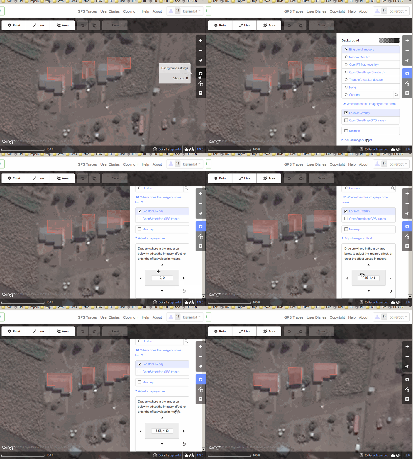
How to use Tasking Manager (in Japanese)https://www.youtube.com/watch?v=Arco-pvxf88 How to adjust background imagery in iD editor |
|
台風15号(Fah-sai) 2019 建物マッピング MEMO概略EN概略JA |
九州北部豪雨 2020 建物マッピング. 熊本県球磨川氾濫概略EN概略JASpecial Project Notes
How to use Tasking ManagerHow to adjust background imagery in iD editor |
Requiem mapping for the 2011 Tōhoku earthquake and tsunami, Building/Roads Mapping. Natori, Miyagi, Japan東日本大震災 2011 建物/道路 鎮魂マッピング. 宮城県名取市 Short descriptionDescriptionChangeset commentBuilding/Roads Mapping in #Natori #hotosm-project-10530 #CrisisMappersJAPAN #FuruhashiLab #DRONEBIRD #YouthMappersAGU #amazonpsas Detailed instructions |
2024年1月1日令和6年能登半島地震用テンプレート(作業中)Sea of Japan earthquake, 2024 Building and Road Mapping. Suzu, Ishikawa, Japan令和6年能登半島地震 2024 建物・道路マッピング. 石川県珠洲市Sea of Japan earthquake, 2024 Building and Road Mapping. Wajima, Ishikawa, Japan令和6年能登半島地震 2024 建物・道路マッピング. 石川県輪島市概略EN概略JASpecial Project NotesSpecial Project Notes |
|
hoge |

プロジェクト名命名ルール v1.0
English
日本語
MEMO
概略テンプレート
English
Heavy Rain, Floods and Landslides happened in South West area of Japan.
(2018/07)
Disaster Volunteer teams are working in this affected area.
We will support for them. First mission means making building data.
If you have time, please help to us. Thanks!!
Typhoon Hagibis attacked Japan, Oct 12, 2019.
Heavy Rain, Floods and Landslides happened in Central and East area of Japan.
Disaster Volunteer teams will work in this disaster affected area.
We will support for them. First mission means making building data.
If you have time, please help to us. Thanks!!
日本語
日本の南西部に線状降水帯が長時間豪雨をもたらし複数箇所で洪水や土砂災害が発生しました。
(2019/07)
日本赤十字社と連携し、彼らの活動エリアを中心にOpenStreetMapの建物データを充実させることを目的にこのタスクプロジェクトを立ち上げました。お時間ある方、ご協力よろしくお願い致します。
台風19号(アジア名 ハギビス)が中部日本から東日本にかけて襲来し、各地で河川氾濫や土砂災害、竜巻被害が発生しました。
今後の災害ボランティア活動が活発となるエリアを中心に、OpenStreetMapの建物データを充実させることを目的にこのタスクプロジェクトを立ち上げました。お時間ある方、ご協力よろしくお願い致します。
対象の地物
航空写真
IT-DARTチームによる被災状況の情報収集 on Facebook
https://www.facebook.com/groups/1755301231243802/
解説テンプレート
English
日本語
マッピング対象
変更セットのテンプレート
○○○エリアの建物入力 #hotosm-project-xxxx #TyphoonFah-sai #DRONEBIRD #FuruhasiLab #CrisisMappersJAPAN #地域名○○○エリアの○○入力 #hotosm-project-xxxx #TyphoonFah-sai #DRONEBIRD #FuruhasiLab #CrisisMappersJAPAN #地域名鋸南町エリアの建物入力 #hotosm-project-6743 #TyphoonFah-sai #DRONEBIRD #FuruhasiLab #CrisisMappersJAPAN #鋸南町新島エリアの建物入力 #hotosm-project-6802 #TyphoonFah-sai #DRONEBIRD #FuruhasiLab #CrisisMappersJAPAN #新島Building Mapping in Nagano #hotosm-project-6980 #TyphoonHagibis #CrisisMappersJAPAN #FuruhashiLab #DRONEBIRD #NaganoBuilding Mapping in Sagamihara #hotosm-project-6981 #TyphoonHagibis #CrisisMappersJAPAN #FuruhashiLab #DRONEBIRD #SagamiharaBuilding Mapping in Sano #hotosm-project-7012 #TyphoonHagibis #CrisisMappersJAPAN #FuruhashiLab #DRONEBIRD #Sano航空写真
発災後の撮影画像が入手できるまでは位置精度と分解能が高い「地理院地図シームレス空中写真」を原則用いる。但し撮影時期が古い点を注意する。
https://cyberjapandata.gsi.go.jp/xyz/seamlessphoto/{z}/{x}/{y}.jpg発災後の衛星画像/空中写真が入手できる場合は適宜使用する。特に地理院地図のTwitterアカウントによる最新情報をウォッチする。
https://twitter.com/gsi_cyberjapan
発災後のDRONEBIRD空撮画像が公開された場合はその画像を使用する。
https://www.facebook.com/dronebirdproject/
The text was updated successfully, but these errors were encountered: